


Based on the East of England commute belt.
The area within an hour of London across the East of England is often treated as a single “commuter belt”, but in reality it behaves like a patchwork of very different settlement types. You move quickly from densely connected rail towns into near-rural villages, and that shift is reflected clearly in crime patterns. While the wider region includes busy urban centres and transport corridors, the consistently lowest-crime neighbourhoods tend to cluster in village-led parts of Hertfordshire and South Cambridgeshire, where population density is lower, housing is more stable, and day-to-day activity is far less transient.
These are not just snapshots — they are neighbourhoods that repeatedly sit in the lower band of their districts over rolling 12-month periods, which is what makes the pattern meaningful.
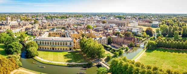
Understanding safety in the East of England commuter belt
The commuter belt around London in the East of England behaves very differently from both inner London and more remote rural regions. You are dealing with a mix of:
- Historic villages embedded in green belt land
- Wealthy commuter towns on fast rail lines
- Semi-rural neighbourhoods split across multiple settlements
- Edge zones where urban and rural influences overlap
In general, the safest neighbourhoods share a consistent profile: low population churn, high owner-occupancy, limited nightlife economies, and strong local community structures. Where crime does appear, it is typically dispersed rather than concentrated — often reflecting geography and reporting volume rather than high-risk hotspots.
Against a backdrop where many English neighbourhoods sit well above national averages, the lowest-crime commuter-belt neighbourhoods in this sample sit firmly in the lower tail of their local authority distributions, and in some cases significantly below neighboring urbanised areas.
Codicote & Kimpton (North Hertfordshire)
Codicote and Kimpton form one of the most consistently low-crime ward areas in the Hertfordshire commuter belt.
With 191 recorded crimes in 2025, this ward stands out immediately as the lowest in this group. It is defined by a classic North Hertfordshire village structure: small settlements separated by open countryside, limited commercial activity, and very little through-traffic compared to nearby towns.
What matters most here is stability. The population is long-established, housing turnover is relatively low, and there is no major urban centre embedded within the ward boundary. That combination tends to suppress the kind of fluctuations you see in more densely populated commuter areas.
This is one of those locations where the crime figure is less about hotspots and more about scale - and scale is small.
Harpenden North & Rural (Hertfordshire)
Harpenden consistently appears in the upper tier of low-crime commuter towns, and the northern rural section pushes that profile even further.
At 255 crimes in 2025, this ward benefits from a combination of affluence, planning constraints, and commuter-led demographics. Harpenden itself is a highly established rail town, but the “North & Rural” designation extends into quieter fringes where housing density drops and countryside dominates.
The key characteristics here are predictable:
- High levels of owner occupation
- Strong school-driven residential stability
- Direct but controlled rail connectivity into London
- Minimal nightlife or late-evening economy
Unlike more mixed commuter towns, Harpenden’s structure limits the typical urban drivers of crime. The result is a consistently low, stable baseline year after year.

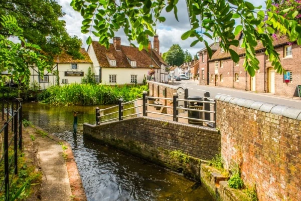
Great Shelford (South Cambridgeshire)
Great Shelford represents the South Cambridgeshire commuter village model at its most typical.
With 293 crimes in 2025, it remains firmly in the lower band of Cambridgeshire neighbourhoods despite being within easy reach of Cambridge and well connected to London via rail links.
The village structure is key. Great Shelford is not a sprawling suburb but a compact settlement with clearly defined boundaries, surrounded by open countryside and separated from larger urban zones. That physical separation plays a major role in limiting both volume and concentration of recorded crime.
It also benefits from a relatively stable commuter population — particularly professionals linked to Cambridge’s employment base — which reduces the population churn often associated with higher crime variability.
Sandridge & Wheathampstead (St Albans)
Sandridge and Wheathampstead sit within the wider St Albans fringe, combining rural hinterland with commuter-linked villages.
At 513 crimes in 2025, this ward remains relatively low-crime, but it is noticeably higher than the pure village-led areas above it. That difference is largely structural.
The ward covers a broader and more mixed geography:
- Multiple settlements rather than a single village core
- Greater commuter flow into St Albans and London
- More varied housing density across the ward area
- Light commercial and service activity in village centres
This is still very much a commuter-belt rural fringe, but one with more movement, more connectivity, and therefore a slightly higher recorded incident volume.
Park Street (St Albans)
Park Street sits closer to the St Albans urban edge and reflects a more connected commuter-suburban profile.
At 881 crimes in 2025, it is the highest in this group, but still sits within what would typically be considered a moderate commuter-belt range rather than a high-crime urban one.
The key difference here is activity level. Park Street is shaped by:
- Strong transport connectivity (rail and road corridors nearby)
- Higher commuter throughput
- Larger and more diverse population base
- Proximity to St Albans and wider retail networks
This combination increases recorded incidents, not necessarily because of residential instability, but because of movement. It is a ward where the “background noise” of activity is simply higher.
Conclusion
Across the East of England’s London commuter belt, a very clear pattern emerges. The lowest-crime neighbourhoods are overwhelmingly village-led, low-density, and structurally separated from major urban centres. Codicote & Kimpton sits at the extreme low end, with Harpenden North & Rural and Great Shelford also forming a consistently stable lower tier.
As you move towards more connected and mixed commuter zones like Sandridge, Wheathampstead, and Park Street, crime figures rise — but largely in line with increased population size, transport connectivity, and movement rather than any fundamental shift in safety.
Ultimately, the data reinforces a simple truth about the commuter belt: in the East of England, structure matters more than postcode reputation. The quieter the geography and the more stable the population, the lower and more consistent the crime profile tends to be over time.